Free Printable Bible Maps – Free printable Bible maps help readers visualize the lands, journeys, and events described in Scripture. Whether you are preparing a Sunday school lesson, leading a small group, studying at home, or teaching children, accurate maps of the Holy Land, the Exodus route, the kingdoms of Israel and Judah, and Paul’s missionary travels make the biblical narrative clearer and more memorable.
This page points you to legitimate, currently available free resources so you can download and print high-quality maps without cost or copyright concerns for personal and non-commercial use.
Why Free Printable Bible Maps Matter?
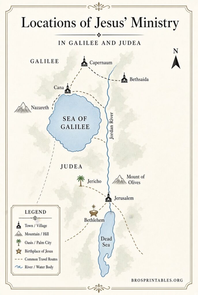
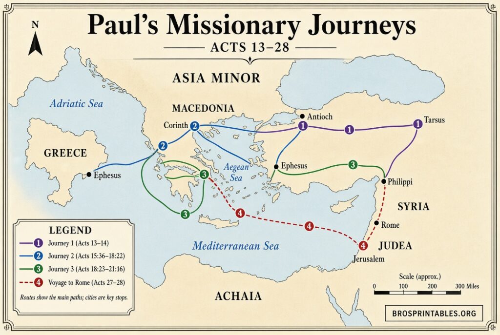
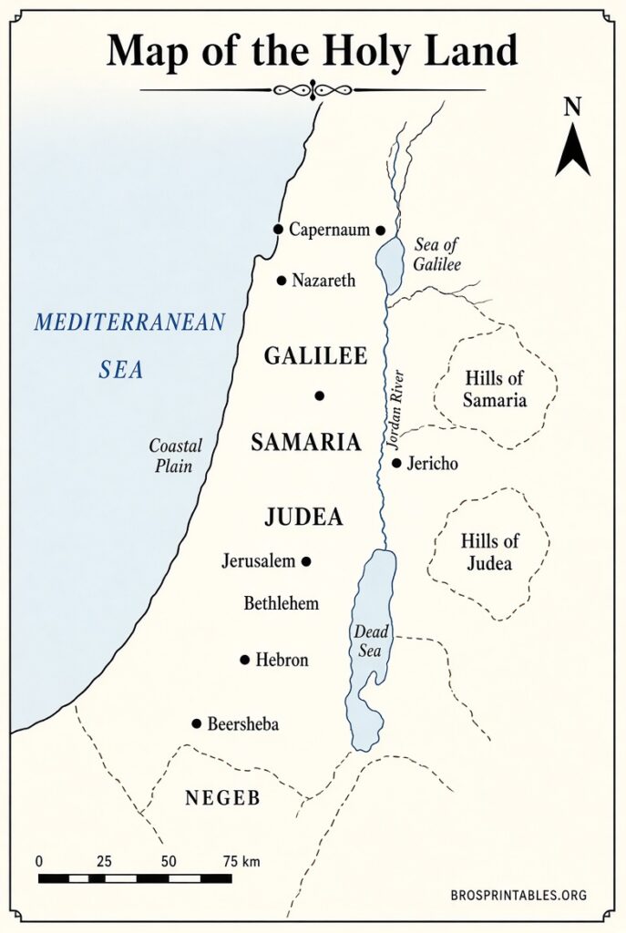
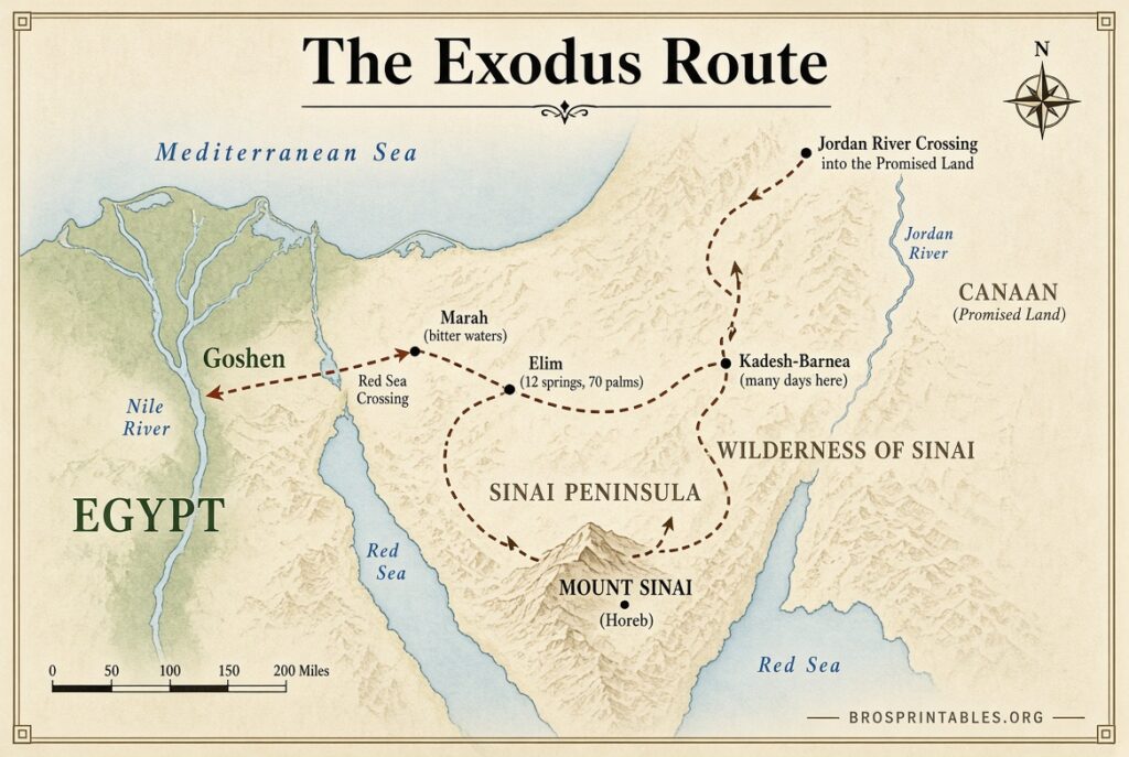
Geography shapes the Bible’s stories. Knowing the distance from Nazareth to Jerusalem, the terrain of the Sinai wilderness, or the route of Paul’s second missionary journey adds depth that text alone cannot provide. Printable maps let you mark locations, compare routes across different time periods, and share visuals in class or at home.
High-resolution files that print clearly at letter or larger sizes are especially useful for wall charts, binders, or projection.
Trusted Sources for Free Printable Bible Maps
Here are five authoritative places offering free, downloadable Bible maps suitable for printing. All links open in a new tab and include the recommended nofollow attribute for external resources.
1. Church Maps (Public Domain High-Resolution Maps)
Large, detailed maps of Palestine in New Testament times, Paul’s journeys (with and without political inset), the ancient world in the patriarchal period, and the Exodus with the conquest of Canaan. All maps are released into the public domain. You may download, print, modify, and redistribute them freely.
Download free large Bible maps at churchmaps.info
2. Knowing the Bible – High-Resolution Bible Maps
Dozens of maps at 6000 × 4500 pixels and 300 dpi, sized for printing up to 20 × 30 inches. Coverage includes the Near East, Canaan, the Exodus, tribal allotments, the divided kingdom, the empires of Assyria through Rome, Israel in Jesus’ time, and all of Paul’s journeys. Free for personal, teaching, and non-commercial use (copyright notice must remain). A complete zip of all maps is available.
Get free high-resolution Bible maps at knowingthebible.net
3. Bible.ca – 100 Free High-Resolution Bible Maps
Extensive collection of satellite-based, archaeologically informed maps covering the Exodus, conquest, united and divided kingdoms, and many other periods, plus chronological timelines. Free for personal use, church presentations, and Bible studies. Do not alter the maps or post them on other websites.
Access free printable Bible maps at bible.ca/maps
4. Internet Sacred Text Archive – Historic Public-Domain Maps
Scanned maps from an 1888 American Bible Society edition. Includes the Sinai journeys, tribal divisions of Canaan, the kingdoms of David and Solomon, Judah and Israel, and Paul’s missionary journeys. Fully public domain and free for any use.
View and print classic Bible maps at sacred-texts.com
5. Headwaters Christian Resources – 41 Free Digital Bible Maps
A complete set of 41 maps covering key Old and New Testament stories (Abraham’s journeys, the Exodus, conquest campaigns, Jesus’ ministry, and Paul’s travels). Available free with a simple newsletter signup. Licensed under Creative Commons Attribution-NonCommercial-ShareAlike 4.0.
Request the free 41-map set at headwatersresources.org
Free Printable Bible Maps
Practical Tips for Using Free Printable Bible Maps
- Print on heavier paper or cardstock for durability, especially for repeated classroom use.
- Use letter size for individual study binders and larger formats (or tiled printing) for wall displays.
- Black-and-white versions save ink; color versions highlight elevation and routes more clearly.
- Combine maps with a simple timeline so students can connect geography and chronology.
- Always check the license notes on each site before sharing or adapting the files.
Brief FAQ
Are these maps really free?
Yes. The sources listed above clearly state that the maps are free for personal, educational, or non-commercial church use. Always respect any remaining copyright notices or attribution requirements.
Can I use them in Sunday school or homeschool?
Yes. All five resources permit classroom and home teaching use under the stated terms.
What resolution should I look for?
Aim for at least 300 dpi or image dimensions around 6000 × 4500 pixels if you plan to print larger than letter size. The Knowing the Bible and Church Maps collections meet this standard.
Do I need special software?
Most maps download as PNG, JPG, or PDF files that open in any standard viewer or browser. Source files (when offered) can be edited in free programs such as Inkscape or GIMP.
Free printable Bible maps turn abstract place names into concrete locations and journeys. Start with the high-resolution public-domain and Creative Commons collections above, print the maps that match your current study, and keep them handy for reference. They remain among the simplest and most effective tools for deeper Bible engagement.